Nature Intelligence
Private Reviewer Site

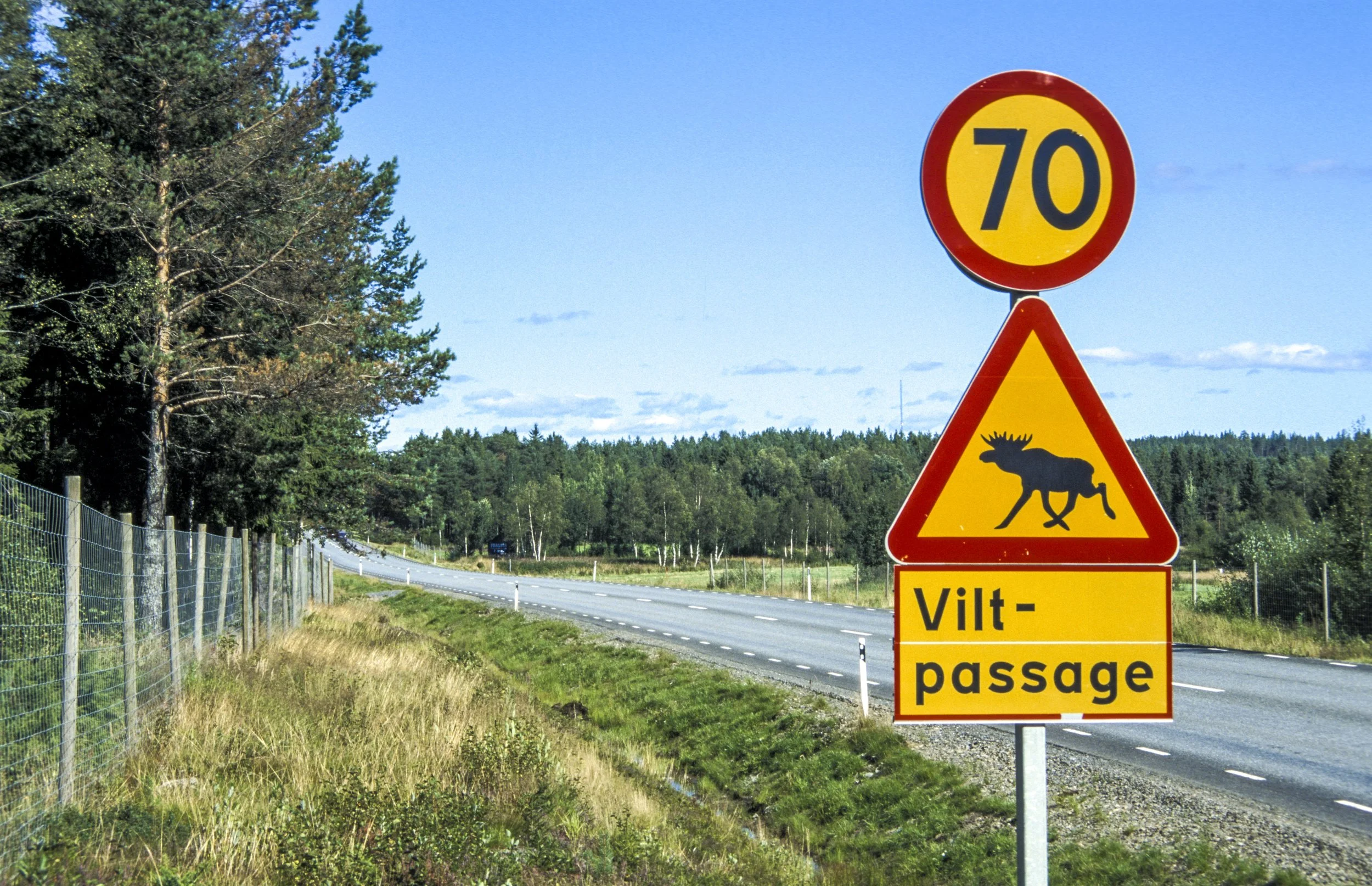
Asian Longhorned Beetle (Anoplophora glabripennis). As they become established in their non-native habitats, ALB infestations force costly removals and quarantines that strain municipal budgets and jeopardize industries reliant on healthy maples and other susceptible species.
The annual cost of invasive species exceeds US $423,000,000,000 globally.
Invasive species are one of the most urgent threats to global biodiversity, reshaping ecosystems, threatening economies, and endangering public health. They alter soil chemistry, degrade habitat, block waterways, and displace native vegetation. These ecological impacts carry major financial consequences. Global damages now exceed $423 billion USD each year (Diagne et al., 2021, Nature), and costs in the United States surpass 120 billion USD annually (Pimentel, Zuniga & Morrison, 2005).
USDA Forest Service studies show invasive shrubs can reduce native seedling recruitment by up to 90 percent in northeastern forests, slowing the transition to mature stands (Fagan et al., 2019). Early removal is consistently 5 to 10 times cheaper than late intervention, a pattern documented by state natural resource agencies across the region (Westbrooks, 2004).
And yet, simply knowing the costs of invasive species does little to solve the problems leading to their proliferation.
To be transformative, Nature Intelligence requires human-centered preconditions to activate desired behaviors.
Even when human beings have abundant ecological information, converting insights into coordinated action requires framing within human-centered design, if the information is to be actionable, measurable, and effective as intended.
The failed Trillion Trees initiative illustrates this gap clearly - a well-meaning campaign that celebrated momentary ecological action but lacked the behavioral architecture required to translate knowledge into long-term forest recovery through established collaborative networks (i.e., SMEs).
Without an understanding of how momentary behavior transitions into long-term stewardship behavior (i.e., maintenance) the campaign failed. This information-action gap is just as visible in invasive species management, where early warnings seldom trigger timely responses, and where human behavior - not ecological knowledge alone - determines whether interventions succeed. Our work situates nature intelligence within a behavioral framework that helps communities act on what they already know, closing the gap between observation, intention, and meaningful ecological outcomes.
Introducing Naughtweed.
Naughtweed helps SMEs locate, evaluate, and prepare nature-related decisions aligned with TNFD’s LEAP framework as it relates to ecological threats (e.g., invasive species) and benefits (e.g., pollinator habitat). From the ground up, the platform is being designed for low-connectivity environments and minimal training, and is ready for January–March 2026 testing.
Who is this for?
Through many conversations with companies of all sizes, we have learned that ecological action inside SMEs is choreographed by three key personas: Stewards, Fellows, and Responders. Each plays a distinct role in how nature-related decisions are made, data is gathered, and on-the-ground work is carried out. Together, they form the internal-external network that determines whether an invasive species problem is simply observed or meaningfully addressed.
Stewards are professionals responsible for land management and landscape health. They are the primary SME customer, able to create initiatives, set priorities, and coordinate internal teams or contractors. Fellows are the staff, volunteers, or community partners who collect observations during normal fieldwork or recreation. Their contributions build the ecological signal that Stewards rely on. Responders are treatment professionals - internal crews or external service providers - who use this aggregated demand to plan, price, and complete removal work. By aligning these three roles in a clear chronology, Naughtweed makes it easier for SMEs to turn scattered observations into actionable restoration.
Naughtweed accelerates response speed via choreographed nature-based management.
The information-action gap is ultimately a behavioral gap: communities often know what is happening ecologically, yet lack the structures, cues, and capacities that prompt them to act when action still meaningfully changes outcomes. This is why the Invasion Curve is not just an ecological model but a behavioral one.
The left side of the curve represents a window where small, early behaviors - noticing, reporting, sharing, coordinating - compound into the possibility of eradication, while delays push populations into the steep, costly portion of the curve where even motivated communities struggle to respond.
Nature Intelligence succeeds only when systems are designed to make early behaviors easy to perform and clearly connected to downstream impact. In this sense, the curve visualizes what the research shows: timing is behaviorally-based; without human-centered mechanisms that prompt rapid, collective response, ecological knowledge alone cannot shift the trajectory of an invasion. Inherent in transitional and systemic nature-related risks is the risk of human inaction; delayed response allows localized ecological stress to compound into transition, operational, and ultimately systemic risk.
Given that legacy Early Detection and Rapid Response efforts were never designed to exist within robust human behavior principles, they encounter lag and friction. As such, legacy EDRR gold standard falls short.
Simplicity changes behavior.
The Fogg Behavior Model (FBM) posits that Behavior occurs when sufficient Motivation, sufficient Ability (i.e., perceived simplicity) and an effective Prompt occur in the same moment (B=MAP). As such, the FBM is an incredibly simple and powerful framework for understanding how to activate desired ecological behavior. Further, the model explains why abundant data cannot reliably produce timely response: one of these three critical elements is often missing.
Often, motivation is cited as the first thing to amplify, induce, or nudge. But motivation is slippery - it ebbs and flows across and within human contexts (e.g., weekday behaviors are different from weekend behaviors, and thus ethical and desirable behavior activation require different choice architecture). Motivation is affected by sleep, caffeine, relationships, traffic, and so on. Because motivation is slippery, it is a losing strategy when relied upon exclusively for change - both short-term and especially long term.
Motivation is an important element for behavior activation, but significantly less so if we can make desired behaviors seem easy enough to do. The goal is to pair natural swings in motivation with an effective environmental prompt (re: invasive species, this would be a sighting made by a Fellow) paired with a simple action (button press). Finding the natural swing in motivation becomes then an exercise in design thinking and design reseach, as this may differ by the Naughtweed sub-persona (e.,g., Fellows in X age brackets, with given Y experience, during the working hour ranges of Z-ZZ).
This combination reducing friction through simple interactions, minimal training, and low cognitive load. Well-placed prompts then cue action within existing workflows. This shifts nature intelligence from awareness to activation, closing the information-action gap by consistently converting ecological signals into timely, real-world outcomes.
By making invasive species management seem easier to do, Naughtweed’s workflow helps SMEs act on the threat of invasive species that threaten biodiversity, agriculture, and municipal infrastructure.
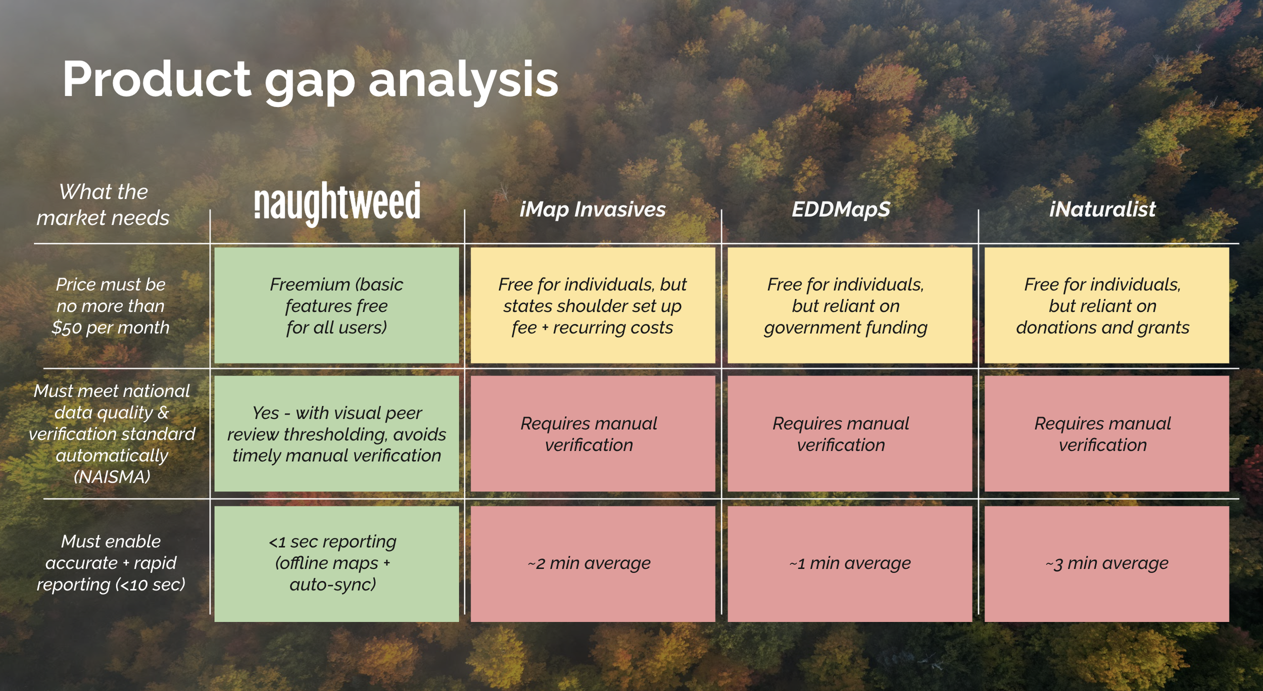
Easier, faster, and cheaper than the competition.
Naughtweed’s advantage comes from removing the friction that slows every other reporting platform. Where competitors depend on tedious workflows, manual verification queues, and funding structures that limit scalability, Naughtweed delivers sub-second reporting through offline-capable maps, automatic syncing, and a visual peer review system that meets national data quality standards without requiring staff intervention. This architecture keeps costs below the market ceiling of $50 per month while still providing enterprise-grade accuracy and compliance.
By combining a freemium model with automated quality assurance, Naughtweed fills a gap that neither iMap Invasives, EDDMapS, nor iNaturalist can meet at scale. These platforms are constrained by manual review pipelines and grant-dependent operations, creating delays that undermine timely EDRR action for SMEs and local governments. Naughtweed resolves these bottlenecks with a system purpose-built for low-connectivity environments and minimal training, enabling rapid, reliable nature-intelligence reporting that aligns with TNFD’s LEAP framework and supports real-world decisions from day one.
Naughtweed offers instant, interactive + actionable value for global SMEs.
Japanese Knotweed: Interactive Case Study
Japanese Knotweed arrived in Maine more than a century ago as an ornamental import, but its resilience has turned it into a major ecological threat. Heavy rain events can fragment its root system, sending live pieces downstream through culverts and storm drains. Along trout streams and riparian corridors, these fragments take root, choke out native vegetation, destabilize soil banks and increase erosion, leading to higher sediment loads and poorer water quality downstream.
What begins as a single patch can, within a few seasons, dominate miles of riverbank.
Naughtweed treats this not just as an ecological problem, but as an coordination design challenge. By connecting ground truth data with SME-citizen scientists, we convert stormwater-driven spread into mappable data - the foundation for rapid, targeted response. Each verified observation builds the shared intelligence needed for early detection and restoration.
The following interactive map shows road-side Japanese Knotweed infestations across the Northern Forest - over 5,000 observations by one person in 28 days. These observations were collected passively while driving (i.e., not during any planned field surveys) using a single physical button press.
This inexpensive button is mounted temporarily on a vehicle dash (but can also be carried into the woods and trail systems); every press adds phone location data, which is then parsed into a map-ready format for early detection visualization. Higher opacity indicates higher observation density, helping identify hotspots before the next storm.
HINT: Hold control (Mac) while scrolling to change the view pitch.
Why build this?
Creative Confidence sparks Ecological Restoration.
At Fable, we believe in the power of human-centered design, in its ability to create preconditions whereby effective ecological restoration is inevitable. This 15-min documentary tells the story of the work that led us to create Naughtweed, from the perspectives of human behavior and emerging technologies. With your support, Naughtweed can be positioned to support ecological business decision-making the world over.


Vetting global evaluation partners - USA + Sweden
We are evaluating the following eight global partners for focused user testing during the Jan-March pilot window, with the explicit goal of studying how Naughtweed might offer reliable performance between two distinct contexts with minimal user input. Specifically, we plan to compare user feedback in n=2 different cultural contexts, informing future interface design decisions that may emerge from organizational similarity and different customs and traditions as relates to our emerging nature technology.
For example, the Maine Department of Transportation and its Swedish counterpart (Trafikverket) are charged with similar mandates (i.e., complex infrastructure networks managed under safety, maintenance, and environmental compliance constraints). A comparison of Naughtweed within both organizations would allows us to examine the transferability of human-centered design in a global relevant context.
Surveying will rely on minimal in-app training and language-light workflows to assess whether field users can generate consistent, high-quality location-based data under real-world conditions. This broader applicability strengthens the case for Naughtweed as a globally relevant nature intelligence tool that delivers immediate value to SMEs.
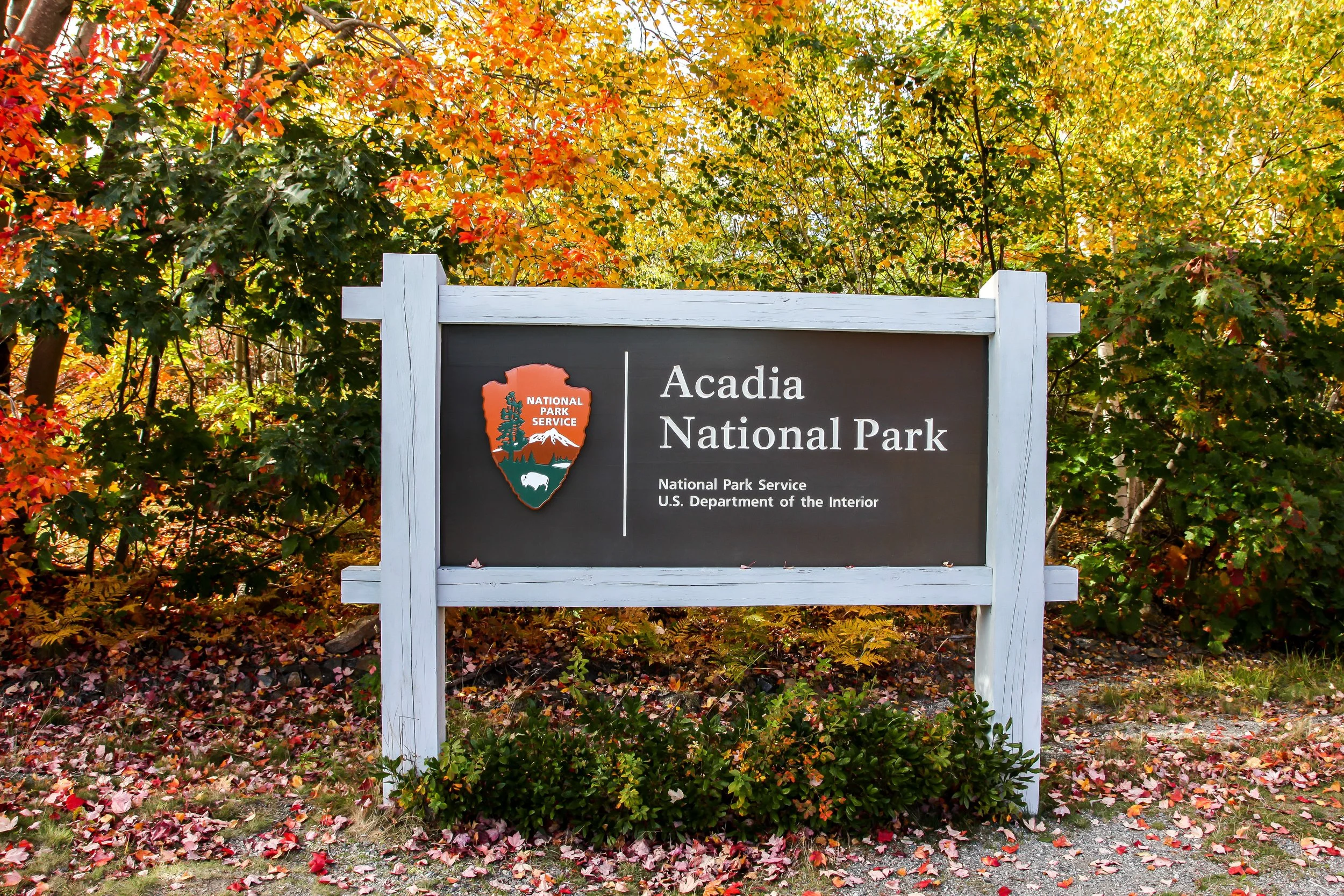
1. Acadia National Park (USA)
Acadia National Park has been selected as a trial site because it offers a rare combination of scale, ecological diversity, operational intensity, and long-term management maturity. Despite its relatively compact size (49k acres), Acadia is one of the most visited national parks in the United States and contains an unusually diverse mosaic of mountains, forests, wetlands, lakes, rugged coastline, trails, and road corridors. High visitation and terrain diversity (especially low connectivity) make Acadia a rigorous and representative environment for testing Naughtweed varied landscapes and diverse field crews.
Suitability for evaluation and testing
Acadia’s 35+ year history of sustained invasive plant management and Early Detection and Rapid Response (EDRR) provides a stable, high-capacity setting for evaluating new technologies. This programmatic maturity enables controlled evaluation of whether a tool improves usability, data quality, and response coordination, rather than simply reacting to overwhelming conditions. In addition, the park’s year-round field operations - spanning invasive species monitoring, forest pest detection, public health risk mitigation, and infrastructure assessment - allow testing to proceed even when seasonal factors (such as winter snow cover) limit certain vegetation workflows. We are in touch with Acadia’s Vegetation Manager for a potential trial this January-March, 2026.
2. Maine Department of Transportation (USA)
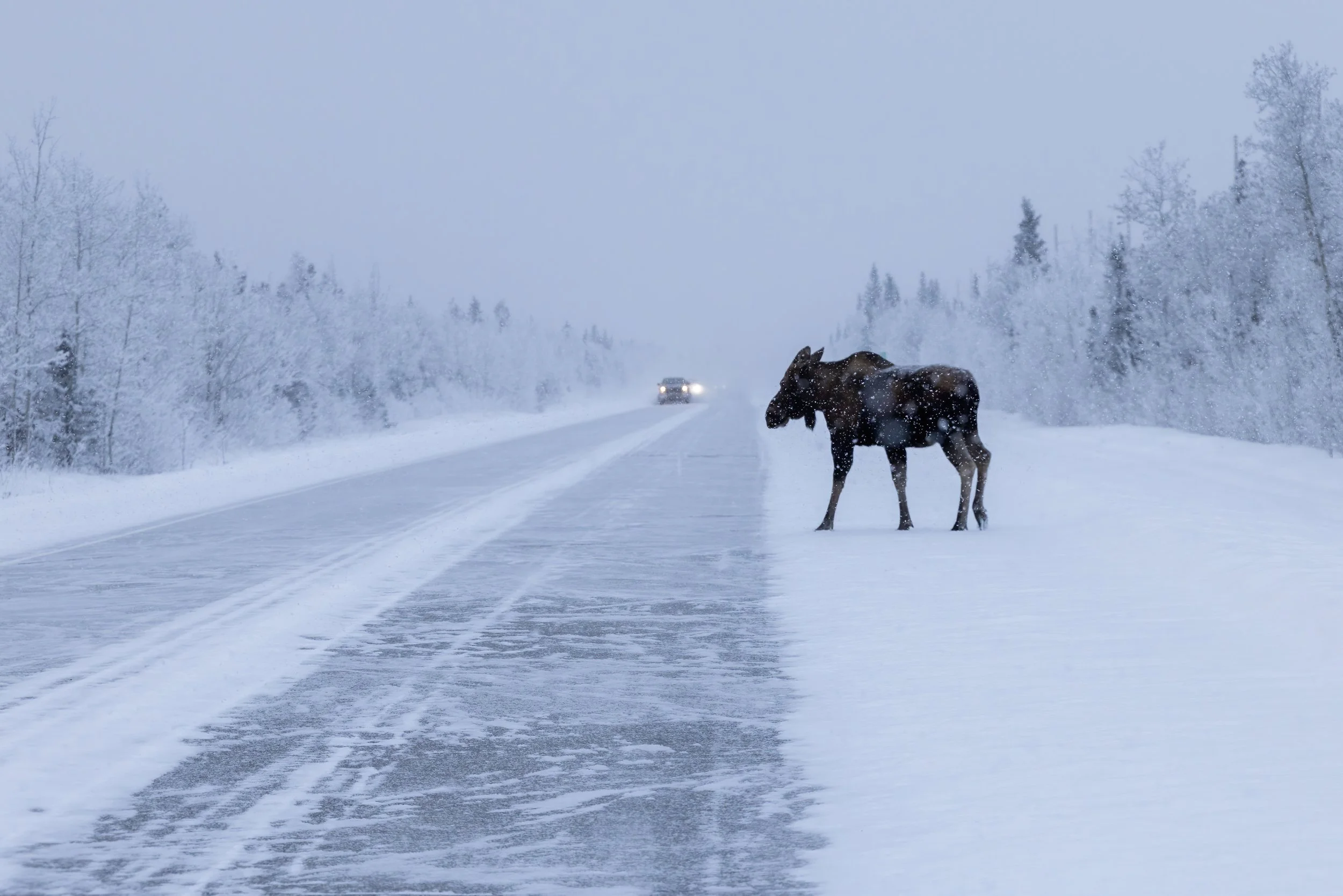
The Maine Department of Transportation (MDOT) would allow us to evaluate Naughtweed in a workflow that constantly responds to natural events as they relate to human mobility. Given MDOT’s field operations depend on rapid, accurate, and repeatable data collection across large, linear transportation corridors, their crews regularly encounter roadside invasive species, road kill, animal corridors, downed trees, washouts, erosion, and other emerging conditions that can escalate into safety risks or capital expenses if not documented early. Naughtweed is designed to reduce friction in these moments by enabling location-based observations that are easier than adjusting a radio volume (for passengers, not drivers), allowing crews to capture critical information without stopping vehicles or using a screen.
Our initial case study focused on roadside Knotweed demonstrates how this approach can extend well beyond invasive species monitoring. The same interaction model can support highway hazard reporting, vegetation management, and public engagement workflows. By relying on a physical button press to generate pinned location data, the system minimizes training requirements and cognitive load while increasing consistency and coverage. As a pilot environment, MDT would offer real-world conditions that test reliability, safety, and usability under time pressure that directly affects global SMEs and citizens.
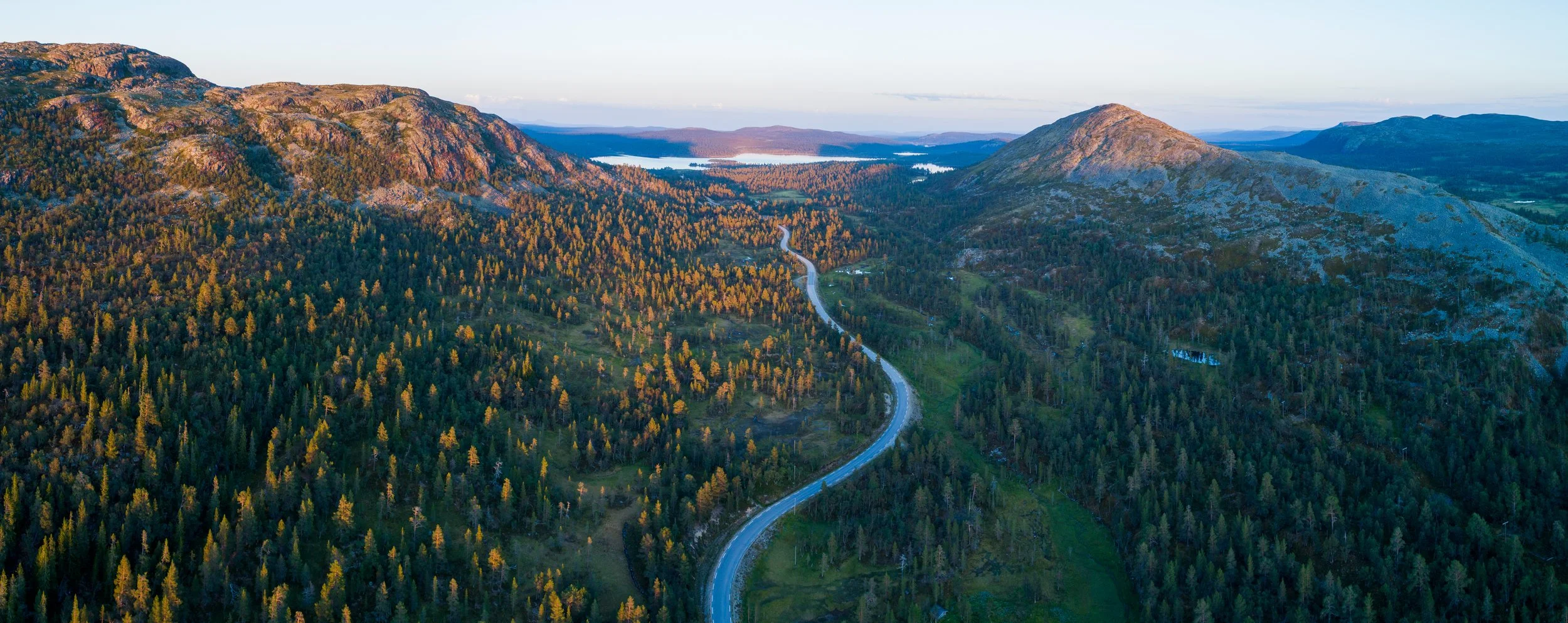
3. Seven Islands Land Company (USA)
Seven Islands Land Company is an ideal partner site because it combines exceptional landscape scale with the operational discipline of a working forest enterprise. Managing more than 800,000 acres of timberland across Maine, Seven Islands operates in remote, weather-exposed, and logistically complex environments where access, timing, and safety directly shape decision-making. Their lands include extensive road networks, riparian corridors, harvested stands, and regenerating forests, all of which intersect with invasive species pressure, vegetation management, and infrastructure risk. This breadth and continuity of land ownership creates a rare opportunity to evaluate nature intelligence tools across large, contiguous landscapes under real commercial constraints, rather than isolated pilot parcels.
Seven Islands’ long-standing commitment to sustainable forestry and technology adoption makes it particularly well suited for rigorous evaluation. As one of the first U.S. timber companies to achieve dual FSC and SFI certification, the organization has an established culture of monitoring, documentation, and adaptive management. Digital maps, drones, tablets, and aerial imagery are already embedded in daily workflows, allowing a new tool to be assessed on whether it meaningfully improves efficiency, situational awareness, and response timing. This maturity ensures the trial tests added value and operational fit, rather than compensating for gaps in baseline capacity.
4. Naturskyddsföreningen (Sweden)
As Sweden’s largest environmental NGO, Naturskyddsföreningen represents a mature and highly trusted institution with decades of experience translating environmental science into public action, policy influence, and education. With more than 200,000 members and a dense nationwide network of local chapters and county branches, the organization provides an established infrastructure for field engagement, data collection, and peer-to-peer learning that would be difficult to replicate through a purely academic or technical partner.
Its work across biodiversity conservation, land use, climate resilience, and sustainable consumption closely overlaps with the ecological challenges this project addresses, particularly early detection, monitoring, and response to landscape-scale environmental change. Naturskyddsföreningen’s strong credibility, large-scale outreach capacity, and regular participation in national campaigns and governmental consultations position it well to pilot and scale tools that rely on consistent field observations, human-centered design, and broad behavioral uptake. As a global partner, Naturskyddsföreningen would bring deep familiarity with the European policy and regulatory context, allowing lessons learned to inform both national and international best practices.
5. Fältbiologerna (Sweden)
Fältbiologerna would be a strong and complementary partner for this project as a youth-led, field-oriented organization with long experience translating environmental concern into hands-on action. As an independent organization formally affiliated with Naturskyddsföreningen, it operates within a trusted national conservation ecosystem while maintaining its own governance and youth-driven culture. With a national network of approximately 2,000–3,000 members aged roughly 6–25, organized through local clubs, camps, and field-based activities across Sweden, its focus on biodiversity, outdoor learning, and peer-to-peer engagement aligns closely with the project’s emphasis on practical, place-based nature intelligence rather than abstract or purely technical solutions.
As a partner, Fältbiologerna would offers a valuable perspective on usability, motivation, and learning among younger participants, a group often excluded from professional monitoring tools despite high levels of engagement in nature. Its strong grassroots presence, participatory methods, and emphasis on leadership development make members well suited to testing intuitive, low-language interfaces under real-world conditions. This directly supports the RFP’s interest in inclusive design, early engagement, and tools that lower barriers to participation while building long-term stewardship capacity.
6. Artportalen (Sweden)
Artportalen would be a highly relevant partner for this project because it serves as Sweden’s national infrastructure for biodiversity observations, bridging citizen science, research, and public decision-making at scale. Operated by SLU Artdatabanken, the platform is widely trusted and used by thousands of citizen scientists, researchers, consultants, and public authorities, generating millions of species observations across Sweden. Its long-standing role in conservation planning and ecological research aligns closely with the project’s emphasis on credible, actionable nature intelligence.
As a collaborator, Artportalen would bring deep experience in large-scale participatory data collection, validation, and long-term stewardship of ecological records. This is directly relevant to the RFP’s interest in tools that produce reliable data at scale while remaining accessible to non-expert users. Engaging with Artportalen enables a meaningful comparison between established, taxonomy-heavy reporting workflows and emerging, low-friction, field-first interaction models.
From a UX and UI perspective, collaboration would allow evaluation of how lightweight, language-minimal inputs could complement existing biodiversity systems, creating a clear opportunity to explore interoperability, data enrichment, and faster early-detection signals within a nationally embedded data infrastructure.
7. Trafikverket (Sweden)
Similar to Maine DOT, Trafikverket would be a strong partner for this project because it operates at the intersection of national infrastructure management, environmental monitoring, and public safety. As Sweden’s Transport Administration, it is responsible for roads, railways, and associated land corridors where invasive species, vegetation management, and wildlife interactions frequently overlap with operational risk. This makes Trafikverket a highly relevant setting for evaluating a nature intelligence tool that must perform under time-sensitive, safety-critical conditions
From a UX and UI perspective, Trafikverket would provide an opportunity to test whether minimal-input, field-ready interactions can support consistent data capture by staff and contractors working across large, distributed networks. This directly aligns with the RFP’s interest in usability, transferability, and decision relevance rather than experimental prototypes. Similar to Maine DOT, Trafikverket has written about tracking contextual environmental signals alongside invasive species, such as roadside hazards, visibility constraints, and vegetation-related safety risks. Partnering in this context would demonstrate how a single, intuitive interface can serve multiple operational needs without increasing cognitive or administrative burden. Insights from this collaboration would help validate the tool’s applicability for small and medium-sized enterprises operating within regulated, infrastructure-heavy environments worldwide.
Our Jan-March UX / UI evaluation framework is already in the works.
A US–Sweden comparative trial rigorously tests Naughtweed’s twin core hypotheses: 1) closing the information-action gap in invasive species management depends on human-centered design, and 2) these behavioral mechanisms can and will transfer across cultures, institutions, and languages to be globally useful.
Sweden offers similar invasive pressures and infrastructure contexts, but different governance norms, cultural behaviors, and baseline environmental literacy, allowing the study to isolate whether barriers to early detection and rapid response are operational and behavioral, as articulated in both the Research Prospectus and the Nature Intelligence reviewer site.
With an on-the-ground Stockholm-based hire supporting collaboration with Flic, this comparison would be central to validating transferability; reviewers are encouraged to download the draft Research Prospectus for our v7 study design and evaluation framework which we are adapting for January (initially built for Summer 2026 eval).
Frequently Asked Questions
-
We are selling three things in one package: Software as a Service (SaaS) subscription, physical buttons that link the pace of the real world contexts to a SaaS subscription, and accessories that ensure these buttons are put into the most convenient place (e.g., small adhesive for vehicle dashboards, clip for backpacks, watch band, etc).
-
Each button has three actions - a press, and double press, and a press and hold. This means that each buttons can be used to track up to three species (or, as others have been curious about, two species and one emergent problem area - such as a trail bridge out).
A press calls for the paired phone’s location, and logs an instance of the timestamp, button press type, and latitude / longitude. In the backend, the user’s selected tracking token (i.e., Knotweed) with their button press type (e.g., single press), so all they see is a heatmap of Knotweed that they’ve clicked through.
Batteries are advertised to last for two years, and there are several other button types we are exploring with our development collaborators at Flic.
-
Naughtweed is field-ready nature intelligence system that makes environmental data collection easier than ever before. Our SaaS includes physical hardware (one-button inputs), lightweight software, and the ability to export data to existing GIS systems (e.g., Avenza, ArcGIS) to ensure SMEs are not paying for duplicate services. While our focus is Early Detection of invasive species that will cost SMEs and their communities billions of dollars each year, users are encouraged to apply the same tool for custom situational awareness, and faster decision-making across land-based systems.
-
In short, both. The three personas we’ve identified (Steward, Fellow, Responder) are equally applicable to internal teams and broader campaigns. Essentially, these personas are the beginning, middle, and end of a nature intelligence story - each highly customizable for internal / broader coordinated actions.
-
While we built Naughtweed to tackle the most pressing management issue facing invasive species management, the system is proving to be broadly useful anywhere organizations need fast, location-based intelligence captured by people already working in the landscape. The common thread across these use cases is human-centered design: lowering the friction of observation so that field staff can record what matters in the moment, without stopping work or switching tools.
For example:
1. Trail and recreation infrastructure intelligence. Through the Trails Stewardship Committee and OpenStreetMap community, Naughtweed can be used to encode time-sensitive trail conditions alongside invasive tagging. Examples include bridges out, washouts, downed trees, erosion hotspots, signage damage, or accessibility pinch points. A single button press or minimal interaction creates a geolocated record that can later be enriched and exported to OSM or agency systems, improving safety, accessibility, and maintenance prioritization.
2. Triage layer for professional ecological assessment. For state invasive species managers, seasonal interns, and contractors, Naughtweed functions as a first-pass triage tool. Rapid observations in the field can flag locations that merit deeper follow-up using existing protocols and databases. Metadata such as habitat context, apparent infestation stage, access constraints, or co-occurring species can be added later, ensuring expert time is focused where it has the greatest impact.
3. Working-forest and land stewardship intelligence. Partners like Seven Islands see value in using the system not only to document ecological threats, but also to positively identify benefits. Field crews can pin pollinator habitat, regeneration success, rare plant sightings, or areas responding well to management. This creates a more balanced, decision-relevant picture of landscape condition that supports both ecological goals and business operations.
4. Infrastructure and safety observations. The same workflow can capture obscured road signs, vegetation encroachment, drainage issues, or storm damage along roads, rights-of-way, and utility corridors. These observations often fall through the cracks because they are noticed opportunistically; Naughtweed turns them into actionable, spatial data.
5. Training, onboarding, and knowledge transfer. Because interactions are simple and repeatable, Naughtweed supports workforce training and consistency across distributed teams. New staff can learn what to look for, while supervisors gain a transparent record of field observations over time.
-
Given that Stewards represent anyone who cares for land, at any scale, a small land trust with little funding might create an invasive initiative. This intiative can then be posted within the Naughtweed network to Fellows to then tag relevant information, creating the Fellowship of support to fill in funding gaps. Fellows are recognized through in-app partner brand rewards (e.g., chance to win discounted winter apparel). Now having added nature inteligence, Stewards can post a more accurate reuquest for treatment, and Respnoders can bid on these jobs within the network, advancing rapid response for effective and scalable mitigation. SMEs can create ‘winvasive’ campaigns to further compensate Fellows and Responders in seasonal efforts to effectively manage the spread of invasive species.
In these ways, when SMEs use Naughtweed externally, every button press becomes both an environmental action and a micro-transaction in a new freelance restoration economy.
-
Invasive species are one of the earliest and most costly indicators of ecological and economic risk. When detected late, they drive up management costs, damage infrastructure, and limit future options. Early detection consistently delivers the highest return on investment.
-
Inadvertent presses are expected and will be addressed as a data science problem to solve (i.e., anomaly detection). Individual points can be reviewed, filtered, or annotated, and reliability comes from patterns over time rather than single observations. Moreover, while collecting data, users typically encode presses for the duration of passing by (or navigating around) a point of interest; this means that a single errant press is less likely to communicate actionable information when displayed as a heat map, which visually prioritizes triage in ‘hot zones’.
-
Naughtweed’s physical buttons remove screens, forms, and heavy training from field data collection. They are designed for gloves-on, time-constrained work and uses language-light, culturally transferable interactions. This makes our approach uniquely useful and usable across sectors, roles, and regions.
-
Naughtweed responds to the five impact drivers of nature change by making ecological pressure visible, actionable, and measurable at the scale where decisions are made.
We can help SMEs detect and manage land and freshwater use change, invasive species introductions, and pollution by linking on-the-ground observations to spatial intelligence and coordinated response, while supporting resource replenishment through restoration tracking and outcome monitoring.
By embedding nature intelligence into routine operations, Naughtweed also strengthens climate resilience indirectly - reducing compounding risks and enabling earlier, lower-cost interventions across these interconnected drivers.
-
We offer flexible pricing based on the number of users and the desired number of buttons (i.e., total number of trackable data types such as Knotweed, Bridge Down, etc); pricing for SMEs will be prototyped during this trial to get an understanding of how SMEs perceived Naughtweed’s value alongside other existing GIS systems.
-
Naughtweed is already being tested in real operational environments and has formal letters of support from public agencies, private landowners, technology partners, and regional business advisors. Partners such as state agencies and large working-forest operators have confirmed readiness to participate in user feedback and testing during the January-March window. The Challenge’s pilot phase directly matches our current stage: validating usability, transferability, and decision relevance before scaling.
Don’t just take our word for it.

Letters of Support for the Nature Intelligence call.


In conclusion.
Dramatic invasive species headlines are only part of the story. The financial weight of invasives is carried not just by landowners, but by the small and medium enterprises that operate closest to the land. When detection is slow, the burden shifts downstream - to the companies responsible for forestry, agriculture, restoration, recreation, and local infrastructure.
Your support can help us reverse these trends. We thank you for your consideration.